
Three main international routes crossed Palestine from south to north (see Map 33).
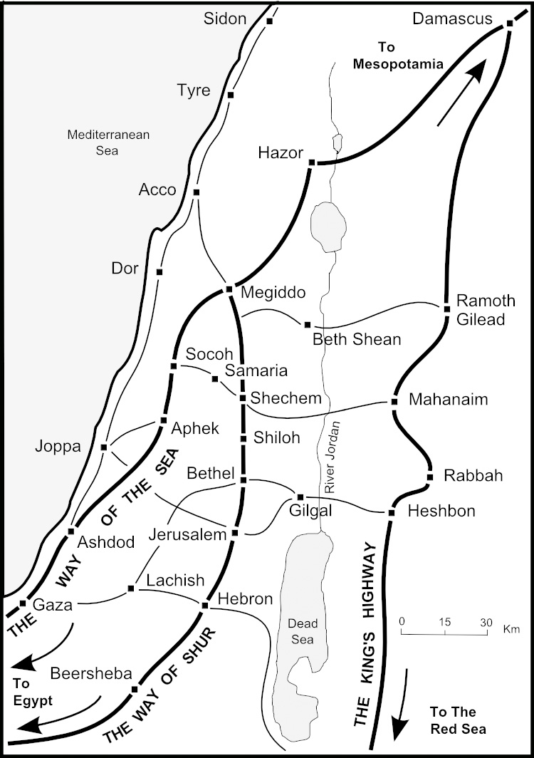
Map 33 Routes across Palestine
1. The Way of Shur - crossed the Negev Desert from Succoth in Egypt to Beersheba and then went north via Hebron and Jerusalem, through the hill country of Ephraim via Bethel, Shiloh and Shechem to join the Via Maris at Megiddo.
2. The King's Highway - went along the high plateau to the east of the Arabah and the Jordan Valley from Ezion Geber on the Gulf of Aquaba north to Heshbon, Rabbah, Mahanaim and Ramoth Gilead to Damascus.
3. The Way of the Sea – the Via Maris - followed the coast from the Nile Delta in Egypt north to Gaza, Ashdod and Aphek before cutting inland across the Vale of Jezreel via Megiddo and Hazor to Damascus and Mesopotamia - the land of the Assyrian, Babylonian and Persian empires.
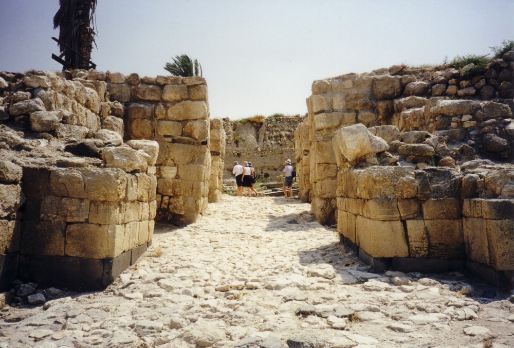
The fortress at Megiddo guarded a strategic routeway
Each of these three main routes was used during Old Testament times:
1. Abraham followed The Way of Shur to and from Egypt (see Genesis 12:10 & 13:1-3), as did Joseph and his father and brothers (see Genesis 37:12-28 & 46:5-7).
2. Abraham pursued the four kings along The King's Highway to rescue Lot (see Genesis 14:14), and the twelve tribes of Israel entered the ‘promised land’ of Canaan along this route (see Numbers 21:22).
3. King Neco led the Egyptian army north along the Way of the Sea en route to Assyria and killed King Josiah of Judah at Megiddo (see 2 Kings 23:29), while King Nebuchadnezzar of Babylon invaded Judah along this route and seized Gaza (see 2 Kings 24:1-7).
Cities such as Megiddo, Shechem and Ramoth Gilead owed their wealth to their location on these important trade routes.